Introduction To Bhutan
Bhutan is a kingdom of tranquility, breathtaking sceneries, historical architecture, and an immensely rich culture.
The country is often referred to as Druk Yul by locals, which translates into “Land of the Thunder Dragon. It’s geographically located along the eastern end of the Himalayas region. The area is engulfed in a vast array of flora and fauna, granting it a natural and humble aesthetic appeal.
Its mountainous landscape makes it the perfect destination for some adventurous trekking. Embark on a journey through hills and valleys to glimpse at ancient structures and religious temples. Majority of Bhutan’s population practices Bhuddism, as reflected in some of its cultural elements and traditions.
In modern times, Bhutan has grown to become one of the most popular travel destinations for thrill-seekers and spiritual exploration.

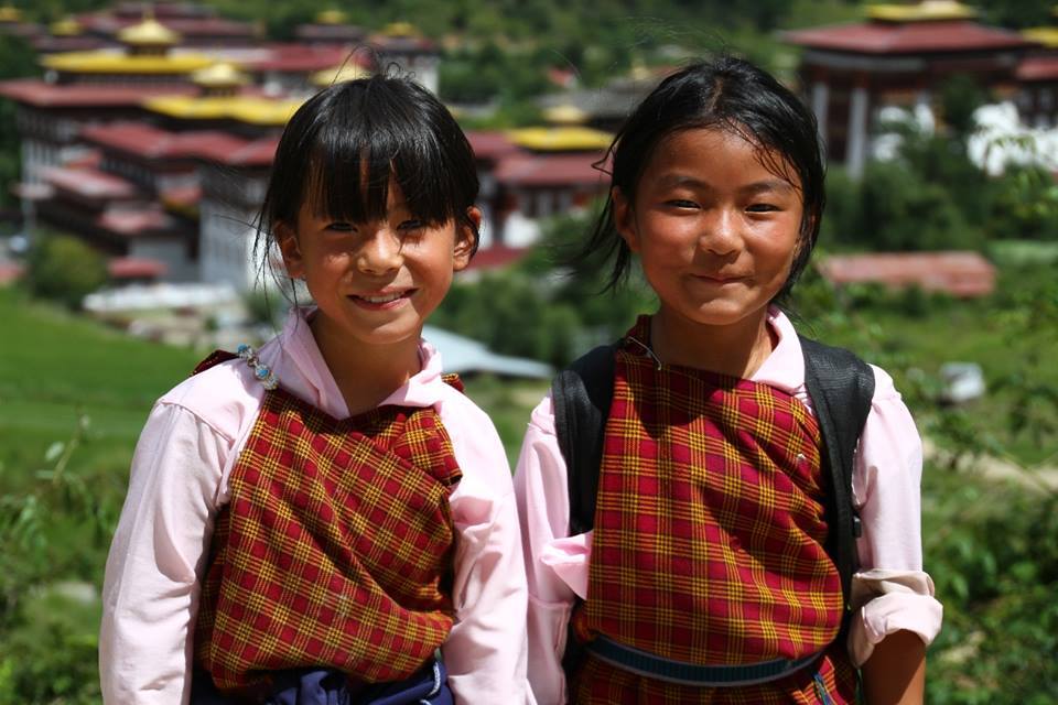
The Culture
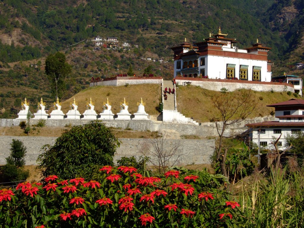
Festivals in Bhutan are representative of its ancient Buddhist culture. These festivals are held in all districts in honour of Guru Rinpoche, the saint who introduced Buddhism to Bhutan in the 8th century. Tsechus are held on auspicious days and months in the Bhutanese calendar, and last up to four days in which series of highly stylised masked dance ritual are performed.
Festivals are considered to be important social occasions. People dress up in their finest clothes and most resplendent jewellery of coral and turquoise. They pack picnic lunches in their traditional bamboo baskets and stall all day at the festivals which are usually held in monasteries.
The Climate
Bhutan has four distinct seasons. Spring if from March to May, where the spectacular flaming red, pink, and white of the rhododndron blossom. During June and July are the monsoon months that bring occasional heavy rainfalls in the afternoon. Autumn season is from September to November, where the days grow shorter and evening s become cooler lovely crisp clear skies. It’s the ideal season for trekkers.
December to the end of February (around Bhutanese New Year), the southern regions, being much lower have a more warmer winters. Is is also the best best of the year to view the snow covered peaks of the Himalayas. October to November and April to mid June are the best times to visit – rainfall is at the minimum and temperatures are conducive for sightseeing.

The Language
Bhutan’s national language is Dzongkha. Here are a few basic phrases to help you along the way.
Respectful greetings (use this when meeting new people) – Kuzuzangpo La
May all good things come to you (use this as a farewell) – Tashi Delek
Thank you – Kardenche
Monastery – Goempa
Temple – Lhakhang
Toilet – Chabtshang
Water – Chuu
Whiskey – Arra
Beer – Bang Chhang
Yes – Ing
No – Me
The Food
Bhutanese love a good kick of spiciness; their food is hearty and wholesome. Bhutanese dishes are kept simple. They mainly consist of boiled foods, but with fresh ingredients. Red rice is most widely eaten by Bhutanese, but white polished rice is common as well. Most meals are also accompanied by ‘Dal’ (Indian split orange lentil soup) in urban areas,
‘Suja’ is a non alcoholic drink- salt tea with butter. Milk tea is also commonly drunk. Bhutanese enjoy alcohol, and they have homemade alcohol that is worth trying. Ara is rice wine similar to the Japanese ‘Sake’. ‘The traditional alcoholic beverages are consumed hot, and fried eggs or rice may be added to it. Bhutan also produces Whiskey, Rum, Gin, and Brandy of excellent quality.

Bhutan's Geography
Learn about the different districts and areas in BhutanWestern Bhutan
This is the captial of Bhutan with a population approximately 100,000 people. Thimphu the largest town in Bhutan, became the capital in 1961. It is an hour drive from Paro airport. The places to visit in Thimphu include the Textile Museum, the Trashichho Dzong, the National Memorial Chorten, and the vegetable market where one can see the local produce and handicrafts. Buddhist can visit numerous montasteries and nunnery round the valley.
Thimphu district streches goes past Dochu-la pass. The 108 Druk Wangyal chrotens on the top of the pass where the ridges are draped in colourful prayer flags.

Place to visit include Paro Dzong, National Muesum housed in a round fortress called the Ta Dzong. The Tiger’s Nest or the Taktshang is one of the most popular spirtual heritage sites.

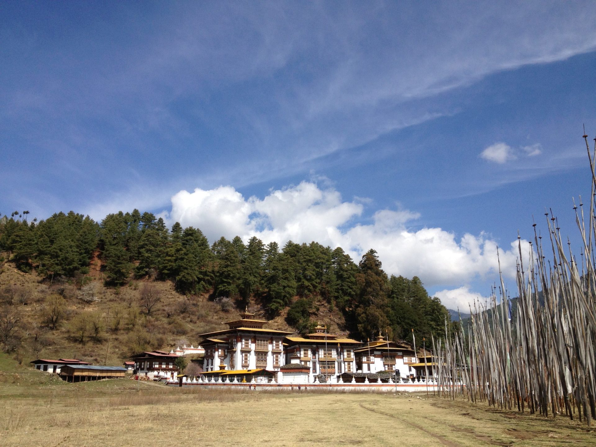
Punakha is the previous capital of Bhutan. You could visit the Punakha Dzong built in 1637.

South of Punakha is the valley of Wangduephodrang as the national highway head toward central Bhutan. An old town, a narrow street with single storied shops. You could visit Wangduephodrang Dzong that is on a steep ridge overlooking the highway that leads to the east and south of the country.
Central Bhutan
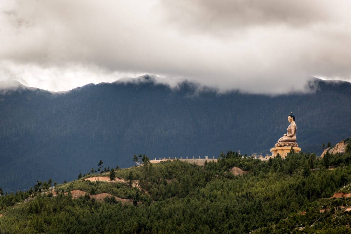
This region that spans from 2,600-4,500m is the religious heartland of the nation and home to some of its oldest Buddhist temples and monasteries. Tales of Guru Padmasambhava and the tertons (“religious treasure-discoverers”) still linger in this sacred region. The district is sub-divided into the four blocks of Chokhor, Chumey, Tang and Ura. The valleys are broad and gentle carved by the ancient glaciers. The wide and scenic valleys draws a large number of tourists each year.

Located along the way to the Tang village over the feeder road under Bumthang valley, it takes thirty minutes drive to the Mebar Tsho from the Chamkhar town. Mebar Tsho is considered one of the most sacred sites in the region as it relates to the renowned treasure reveler, Terton Pema Lingpa-incarnated disciple of Padmasambhava who discovered treasure from the lake somewhere around late

Pelela pass at 3300m is an important dividing range that separates Western Bhutan from Central and Eastern Bhutan. Crossing this important Pass, one may enjoy the pastoral feeling as you drive deeper into the valley with meadows where sheep and yaks graze. The bamboos that grow plenty on these hillsides are trimmed by yaks. Yaks love the dwarfed bamboos. If you are a bird watcher, look out for the specialty called the Wren Babbler taking refuge underneath those bamboos. In the months of April-June, the hillsides are painted with the rhododendron blooms. Trongsa, the sacred and the temporal heart of the country is the first district that you will come across.
Eastern Bhutan

In the north-eastern corner of Bhutan lies the ancient region of Kurtoe or Lhuentse as it is known today. It is the ancestral home of our Kings and boasts some sacred sites of pilgrimage in the country. It is located 77km from Mongar (3 hours’ drive) and is one of the most isolated districts in Bhutan. The landscape is spectacular, with stark cliffs towering above river gorges and dense coniferous forests. The region is famous for its weavers, and their distinctive textiles are generally considered to be the best in the country. Kishuthara is one textile that the Kurtoep women are deft in weaving.

Mongar, one of the six districts that make up eastern Bhutan borders Bumthang, Lhuentse, Pema Gatshel and Trashigang. The district covers an area of 1,954 sq.kms with elevations ranging from 400m to 4,000m and has a population of about 38,000. The landscape is spectacular with stark cliffs an gorges and dense conifer forests. The region is known for weavers and textiles and fabrics considered one of the best in the country.
It was known in the past as the bastion of the Zhongarps for it produced some of the finest administrators in the country whose descendants still continues to lay an active part in the political scene of Bhutan.

The gate way to Eastern Bhutan, Samdrup Jongkhar is situated in the south eastern part and shares borders with the Indian state of Assam. It is by far the largest urban centre in eastern Bhutan. It lies at elevations ranging from 200m to 3,500m. In the earlier past, many British Political Officers stationed in Sikkim took the rote from Samdrup Jongkhar to enter into Bhutan. Historically it was administered by the Gyadrung stationed at Dewangiri. Today the road from Trashigang to Samdrup Jongkhar, completed in the 1960s, enables the eastern half of the country to access and benefit from trade with the south as well as across the Indian border as in the past where it was the main trading centre for the Bhutanese. Samdrup Jongkhar is a convenient exit town for tourists who have arranged to visit the neighboring Indian state of Assam.
Trashiyangtse is a rapidly growing town and the administrative and religious center for the people of Trashiyangtse. It was carved out from Trashigang district in 1992 as a separate district. The district pushes up to into the north-east Indian state of Arunachal Pradesh and elevations range from 1000m to 5000 m. Situated in a small river valley, it is a lovely spot from which to take walks in the surrounding countryside. Trashiyangtse is famous for its wooden containers and bowls, which make inexpensive, attractive and useful mementos of a visit to this remote region.
Trashigang spans the easternmost corners of the kingdom, skirting up to the edge of the Indian state of Arunachal Pradesh, and is the country’s largest district. The district has an altitude ranging from 600 m to over 4000m and Bhutan’s largest river, the Dangmechu, flows through the district. Trashigang town, on the hillside was once the center for a brisk trade with Tibet. Today it is the junction of the east-west highway, with road connections to Samdrup Jongkhar and then into the Indian state of Assam. Trashigang town is also the principle market place for the semi-nomadic people of Merak and Sakteng, whose way of dress is unique in Bhutan.
